
Search Images
Browse Content (p. 21)
Image
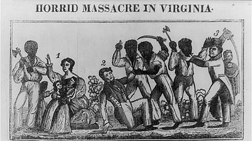
Nat Turner's Rebellion
Nat Turner's Rebellion as depicted in Samuel Warner's Authentic and Impartial Narrative of the Tragical Scene Which Was Witnessed in Southampton County, 1831.
Library of Congress, Washington, D.C.
Image
5 Terms of Convenience in History
Throughout the study of the past, historians have relied on broad conceptual shortcuts to categorize time, societies, and developments. While these models help structure historical analysis and provide useful comparisons, they can oversimplify...
Image
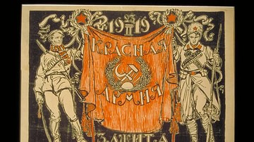
Red Army Poster
A lithograph propaganda poster encouraging support of the Red Army by an unknown artist, 1919. The poster features two figures: on the right a soldier in a cossack-style hat and coat, holding a rifle, and on the left a proletarian worker...
Image
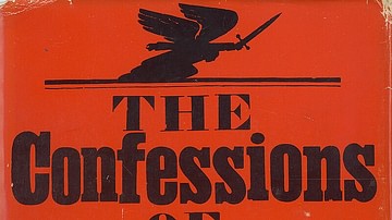
Cover of the 1967 Novel The Confessions of Nat Turner by William Styron
Cover of the 1967 novel The Confessions of Nat Turner by William Styron based on the 1831 Confessions of Nat Turner by T. R. Gray. Designed by Paul Bacon.

Image
Belmont Plantation, Southampton County, Virginia
Front of the Belmont Estate House, located on Buckhorn Quarter Road east of Capron in Southampton County, Virginia, United States. Built in 1790, it was the site of the concluding episode of Nat Turner's Rebellion on 23 August 1831. It is...
Image
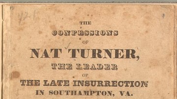
The Confessions of Nat Turner
Title page of The Confessions of Nat Turner by T. R. Gray, printed by T. H. White, 1832.
Library of Congress, Washington, D.C.

Image
Fugitive Slaves in the Dismal Swamp
Fugitive Slaves in the Dismal Swamp, Virginia, oil on canvas by David Edward Cronin, 1888,
New York Historical Society.
Image
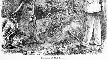
Discovery of Nat Turner
Discovery of Nat Turner, wood engraving by William Henry Shelton illustrating Benjamin Phipps's capture of rebel slave leader Nat Turner (l. 1800-1831) on October 30, 1831.
Image
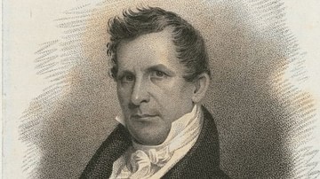
John Henry Eaton
John Henry Eaton (1790-1856), US secretary of war, etching by James Barton Longacre.
The Miriam and Ira D. Wallach Division of Art, Prints and Photographs: Print Collection, New York Public Library.
Image
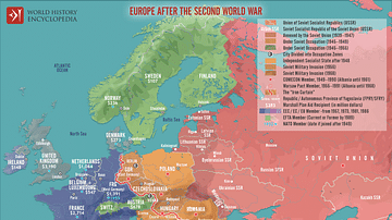
Europe After World War II (1945 to c. 1989)
This map illustrates the realities in Europe after the Second World War (1939-45), as the continent was divided between the Western bloc, backed by the United States, and the Eastern bloc, controlled by the Soviet Union. To rebuild Western...