
Search Images
Browse Content (p. 416)
Image
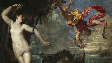
Perseus and Andromeda
Perseus and Andromeda, oil on canvas by Titian, 1554-1556.
The Wallace Collection, London.
Image
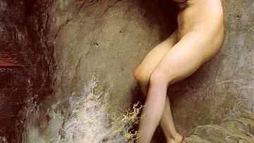
Andromède by Gustave Doré
Andromède (1869), oil on canvas by Gustave Doré. 256.5 x 172.7 cm (100.9 x 67.9 in). Private collection.
Image
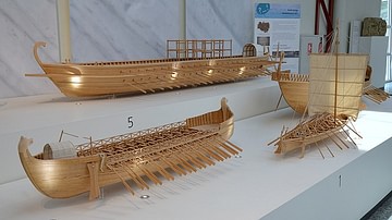
A Byzantine Dromon
1:10 model reconstructions of Roman ships. 5: Dromon of the Byzantine navy (10-12th centuries CE), left: Bireme of the Neumagen type (220-230 CE)
Museum für Antike Schiffahrt, Mainz.
Image
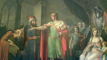
The Court of Robert Guiscard
The brother of the King of Babylonia introduces Constantine the African to the court of Robert Guiscard.
Image
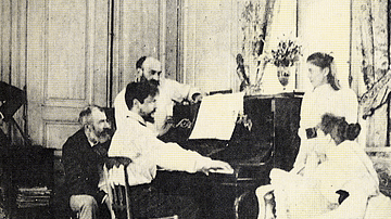
Debussy Playing Piano, 1893
An 1893 photograph of the French composer Claude Debussy (1962-1918) playing the piano in the house of Luzancy with his friend Ernest Chausson.

Image
Claude Debussy by Baschet
An 1884 portrait by Marcel Baschet of the French composer Claude Debussy (1962-1918). (Musée d'Orsay, Paris)
Image
Photograph of Debussy & Stravinsky
A 1910 photograph taken by Erik Satie of the French composer Claude Debussy (1962-1918) and, seated, Igor Stravinsky (1882-1971). (Bibliothèque de l'Opéra Garnier, Paris)

Image
Grave of Claude Debussy
The grave of the French composer Claude Debussy (1962-1918). Cimetière de Passy, Paris.

Image
Claude Debussy, 1908
A 1908 photograph of the French composer Claude Debussy (1962-1918). Atelier Nadar, Paris. (Bibliothèque nationale de France)
Image
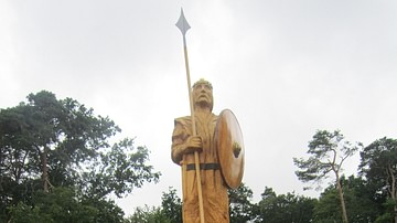
Widukind
Widukind, statue by Uwe Oswald, Goldenstedt, Germany.