
Search Images
Browse Content (p. 435)
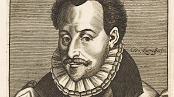
Image
Florimond de Raemond
A 16th-century portrait of the French jurist and historian Florimond de Raemond (1540-1601).
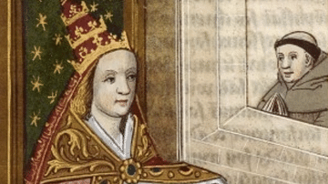
Image
Popess Tarot Card
A c. 1450 tarot card showing a female pope, perhaps inspired by the story of Pope Joan who was a legendary female pope of the Middle Ages said to have reigned from 855 to 858. Her existence is disputed. From the Visconti-Sforza tarot deck...
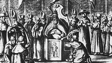
Image
Physical Examination of a New Pope
A 1645 illustration showing a cardinal checking that Pope Innocent X (in office 1644-55) is indeed a man.
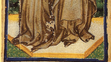
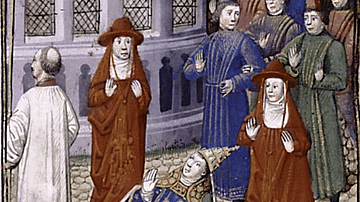
Image
Pope Joan
A 15-16th century manuscript illustration of Pope Joan, a legendary female pope of the Middle Ages said to have reigned from 855 to 858. Her existence is disputed. (Bibliothèque nationale de France).
Image
Pope Joan Giving Birth
A c. 1450 illustration showing Pope Joan giving birth during a procession. Pope Joan was a legendary female pope of the Middle Ages said to have reigned from 855 to 858. Her existence is disputed. (Spencer Collection)
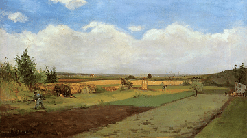
Image
Working the Land by Gauguin
An 1873 oil on canvas, Working the Land (aka Landscape), by Paul Gauguin (1848-1903) the French post-impressionist painter. Painted before Gauguin decided to become a full-time artist and his first major canvas. It shows the influence of...
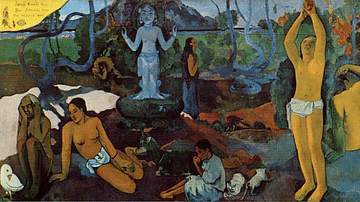
Image
Where Do We Come From? What are We? Where Are We Going? by Gauguin
An 1897 oil on canvas, Where Do We Come From? What are We? Where Are We Going?, by Paul Gauguin (1848-1903), the French post-impressionist painter. This huge frieze-like canvas measures 4.5 metres (15 ft) in length, but none of its ambiguous...
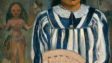
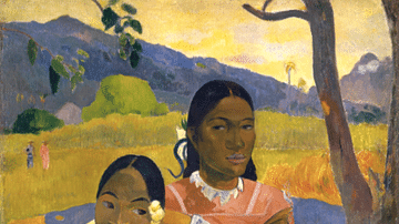
Image
Merahi Metua no Tehamana by Gauguin
An 1893 oil on canvas, Merahi Metua no Tehamana (Tehamana Has Many Parents or The Ancestors of Tehamana), by Paul Gauguin (1848-1903) the French post-impressionist painter. Painted in Tahiti, one of the final works completed by the artist...
Image
When Will You Marry? by Gauguin
An 1892 oil on canvas, When Will You Marry? (Nafea Faa Ipoipo), by Paul Gauguin (1848-1903) the French post-impressionist painter. Painted in Tahiti, the artist obviously valued this work highly since he set it as the most expensive in his...
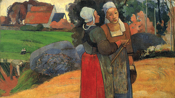
Image
Breton Peasant Women by Gauguin
An 1894 oil on canvas, Breton Peasant Women, by Paul Gauguin (1848-1903) the French post-impressionist painter. Painted in Brittany. The figures are an excellent example of the cloisonnist style where areas of a single colour are bordered...