
Search Images
Browse Content (p. 460)
Image
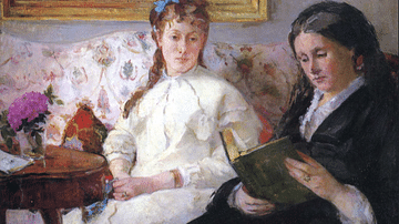
Reading by Morisot
An 1869-70 oil on canvas painting, Reading, by Berthe Morisot (1841-95), the French impressionist painter. The two women are Morisot's mother Cornélie (on the right) and sister Edma (left). Morisot's friend, the artist Edouard Manet (1832-1883...
Image
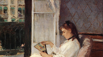
Edma Pontillon at a Window by Morisot
An 1869 oil on canvas painting, Edma Pontillon at a Window, by Berthe Morisot (1841-95), the French impressionist painter. The sitter is Edma Pontillon, sister of the artist. Like other impressionists, Morisot tried frequently the difficult...
Image
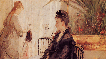
Interior by Morisot
An 1872 oil on canvas painting, Interior, by Berthe Morisot (1841-95), the French impressionist painter. The central figure is the lady of the house while the nanny stands with a child at the window. Inspired perhaps by contemporary fashion...
Image
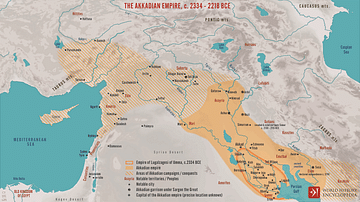
The Akkadian Empire, c. 2334 - 2218 BCE
A map illustrating the rise of the Akkadian Empire from its origins in the city-state of Akkad. For the first time in history, Sargon the Great and his descendants managed to unite the whole of Mesopotamia, keeping the rival city-states under...
Image
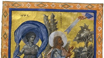
Nyx and the Prophet Isaiah
Manuscript illumination depicting Nyx and the Prophet Isaiah from the Paris Psalter (Parisianus graecus 139, folio 435 verso), c. 940-960. National Library of France, Paris. The prophet Isaiah is flanked by Nyx (Night) and the Dawn. The...
Image
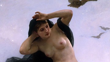
La Nuit (Nyx)
Night (La Nuit), oil on canvas painting by William-Adolphe Bouguereau, 1883.
Hillwood Estate, Museum & Gardens, Washington D.C.
Image
Hide & Seek by Morisot
An 1873 oil on canvas painting, Hide and Seek (Cache Cache), by Berthe Morisot (1841-95), the French impressionist painter. This work was shown in the First Impressionist Exhibition in 1874. (Private Collection)
Image
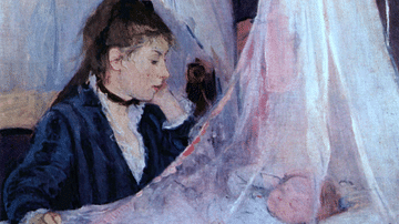
The Cradle by Morisot
An 1872 oil on canvas painting, The Cradle, by Berthe Morisot (1841-95), the French impressionist painter. The figures are the artist's sister Edma and her daughter Blanche. The soft colours suggest the tender relationship between mother...
Image
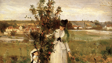
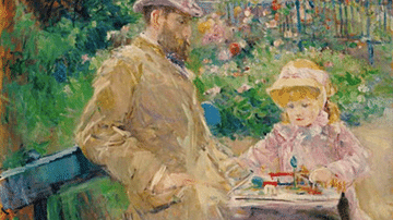
Eugène Manet & His Daughter in the Garden at Bougival by Morisot
An 1881 oil on canvas painting, Eugène Manet & His Daughter in the Garden at Bougival, by Berthe Morisot (1841-95), the French impressionist painter. In a scene she painted several times in various poses, the artist presents her husband Eugène...
Image
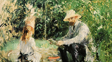
Julie & Eugène Manet in the Garden by Morisot
An 1883 oil on canvas painting, Julie & Eugène Manet in the Garden, by Berthe Morisot (1841-95), the French impressionist painter. In a scene she painted several times, the artist presents her husband Eugène Manet and daughter Julie. The...