
Search Images
Browse Content (p. 470)
Image
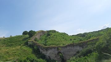
Ruins of the Bastion of the Khotyn Fortress
Ruins of the 18th-century bastion wall, which surrounds the Khotyn Fortress, Ukraine.
Image
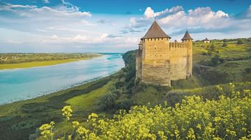
Khotyn Stronghold from the North
North Tower and Commandant's Tower of Khotyn Stronghold.
Khotyn fortress, Ukraine.
Image
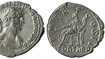
Denarius Commemorating Hadrian's Return to Rome in 118 CE
In Rome, while the emperor was away, people would invoke Fortuna Redux (‘Home-Bringing Fortune’), a particular form of the goddess Fortuna who oversaw a return from a long or perilous journey. Fortuna Redux was first introduced in 19 BCE...
Image
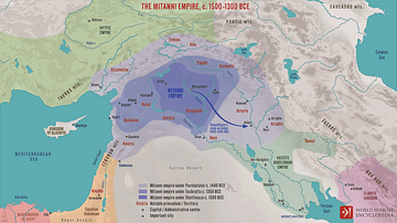
The Mitanni Empire, c. 1500-1300 BCE
A map illustrating the changing fortunes of the Mitanni Empire, an Indo-Iranian society from northern Mesopotamia with its heartland in the Khabur River region, that, at its height c. 1500 BCE, extended from the Zagros Mountains in the east...
Image
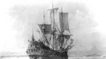
HMBS Roebuck
William Dampier's (1651-1715 CE) ship, HMBS Roebuck, landing in Shark's Bay, New Holland (Australia) in 1699 CE.
Image
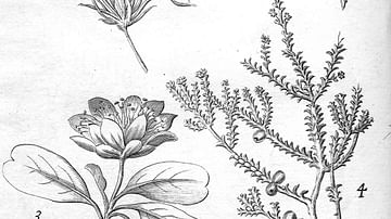
Plants Found in New Holland.
Illustration of Australian plants found in New Holland (Australia) by William Dampier (1651-1715) - from Dampier's book A Voyage to New Holland (1703).
Image
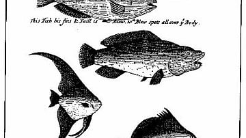
An Illustration from 'A Continuation of a Voyage to New Holland' by William Dampier.
Illustrations of fish off the coast of New Guinea in William Dampier's (1651-1715) book, A Continuation of a Voyage to New Holland.

Image
Map Showing William Dampier's 1699 Expedition Route
Map showing William Dampier's expedition along the west and northwest coast of New Holland (Australia) and the coasts of Timor, New Guinea and New Britain in 1699 aboard the HMS Roebuck.
Image
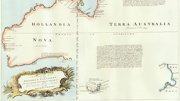
A Map of the Southern Continent
"A complete map of the Southern Continent surveyed by Captain Abel Tasman (1603-1659 CE) and depicted by order of the East India Company in Holland in the Stadt House at Amsterdam, 1774 CE." The map shows the western mainland of Australia...
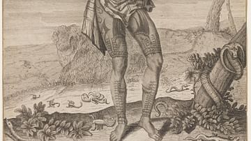
Image
Prince Giolo
Tattooed Philippine prince Giolo (real name Jeoly) of Miangas, who became a slave in Mindanao, and was bought in 1690 CE by the English explorer and buccaneer-adventurer, William Dampier (1651-1715 CE).