
Search Images
Browse Content (p. 503)
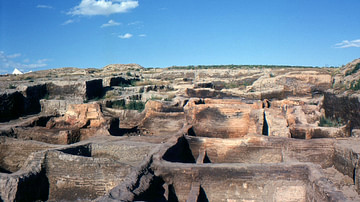
Image
Çatalhöyük
Excavations at the Neolithic settlement of Çatalhöyük, Turkey.
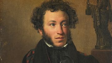
Image
Portrait of Alexander Pushkin
Alexander Pushkin, Russian writer (1799-1837); oil on canvas painting by Orest Kiprensky, 1827.
Tretyakov Gallery, Moscow.
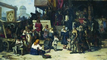
Image
Duke's Court in the Kievan Rus
Knyaz's Court, oil on canvas by Vasily Surikov, 1874.
Tretyakov Gallery, Moscow.
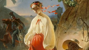
Image
Kateryna
Kateryna, oil on canvas painting by Taras Shevchenko, 1842.
Taras Shevchenko National Museum, Kyiv.
Image
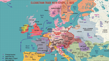
Elizabethan Trade with Europe, c. 1600
A map illustrating the flourishing English trade with Europe during the reign of Queen Elizabeth I of England (r. 1558-1603). Following the abolishment of the Hanseatic merchants' Baltic monopoly, access to a new commodities market in Amsterdam...
Image
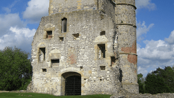
Donnington Castle Ruins
The ruined gatehouse of Donnington Castle, Berkshire England. Built in 1386, the castle played an important role in the indecisive Second Battle of Newbury in October 1644 during the English Civil Wars (1642-51).
Image
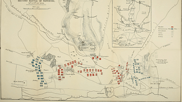
Troop Dispositions, Second Battle of Newbury
The troop dispositions of the Royalists (red) and Parliamentarians (blue) at the indecisive Second Battle of Newbury in October 1644 during the English Civil Wars (1642-51). (1844 illustration by Walter Money)

Image
Bucrania, Ҫatalhöyük
Bucrania or bull's horn decorations were installed in some of the houses of the Neolithic proto-city, Ҫatalhöyük, in central Turkey, inhabited between c. 7400 and c. 5600 BCE.

Image
Reconstructed Interior of a House in Ҫatalhöyük
Reconstruction of the interior of a typical house in Ҫatalhöyük, a Neolithic proto-city in central Turkey, inhabited between c. 7400 and c. 5600 BCE.
Image
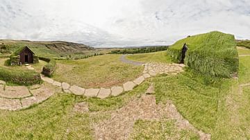
Medieval Turf House and Church
Medieval turf house and church in Iceland. The Icelandic turf farmstead has developed from the longhouse, a Northern European tradition. As their name suggests, turf is one of the main materials used for its construction. Timber is used...