
Search Images
Browse Content (p. 569)
Image
Relief of Dionysus with Restored Colour
Comparison between a relief of a drunken Dionysus with a digitally restored version. Dionysus leans on a satyr while Maenads dance around him. A small Pan tugs on his robe. This restoration shows the relief in the original colours it was...
Image
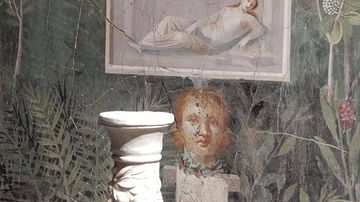
Fresco from the House of Golden Bracelet, Pompeii
Fresco depicting a relief and bust within a garden. From the House of the Golden Bracelet, Pompeii. 1st Century CE.
©Jackie and Bob Dunn www.pompeiiinpictures.com
Image
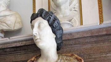
Bust of a Roman Woman, Possibly Lucilla
Roman sculpture of a noble woman, possibly Lucilla, wife of emperor Lucius Verus (r. 161-169 CE). The masterful use of veined marble imitates the pattern of her cloak, while two different marbles give the appearance of white skin and black...
Image
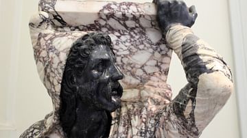
Detail of the Kneeling Barbarian
Detail of the "Kneeling Barbarian", also known as the "Farnese Barbarian". The use of coloured marbles allowed for a polychromatic sculpture without the use of paint or other pigments. Roman sculpture. c. 98-117 CE. (National Archaeological...

Image
The Long Room, Trinity College Dublin
The Long Room is the main chamber of the old library of Trinity College. The room was built between 1712 and 1732, while the roof was raised in 1860 to make room for more books, giving the Long Room its iconic appearance.
Image
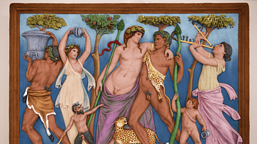
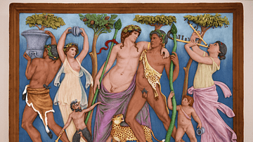
Digital Polychrome Restoration of Dionysiac Relief
Digitally restored Roman relief of a drunken Dionysus between satyr and Maenads. This restoration shows the relief in the original colours it was painted with in Antiquity. Marble. First half of the 2nd Century CE. 80 cm (31.5 in) x 57 cm...
Image
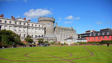
Dublin Castle & the Dubhlinn Gardens
Dublin Castle was for centuries the seat of English and British rule in Ireland. The original castle was constructed by the Norman invaders on the order of King John of England (r. 1199-1216) in 1204. Today, most of the castle consists of...

Image
Roman Lovers
Artist's impression of a young Roman couple in love.
Image
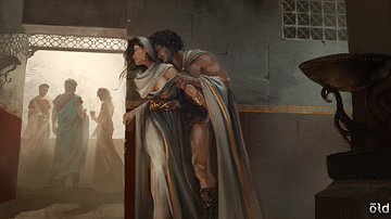
Ancient Lovers
Artist's impression of secret lovers in ancient Greece or Rome. Affairs of both heterosexual and homosexual nature were not uncommon in the ancient world.
Image
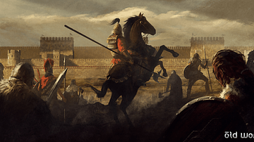
City Under Siege
Artist's impression of an army in front of a large city wall, most likely during Late Antiquity or the early Middle Ages. While this does not depict any specific event, the walls may represent the Theodosian Walls of Constantinople.