
Search Images
Browse Content (p. 651)

Image
Anaxagoras by Langetti
A 17th-century portrait by Giovanni Battista Langetti of Anaxagoras (l. c. 500-c. 428 BCE), the Pre-Socratic Greek philosopher who claimed the First Cause of existence was Mind (nous). (Philadelphia Museum of Art, USA)

Image
Anaxagoras by de Ribera
A 17th-century portrait by Jusepe de Ribera of Anaxagoras (l. c. 500-c. 428 BCE), the Pre-Socratic Greek philosopher who claimed the First Cause of existence was Mind (nous). (Private Collection)
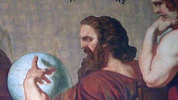
Image
Anaxagoras
A detail of a 19th-century fresco showing Anaxagoras (l. c. 500-c. 428 BCE), the Pre-Socratic Greek philosopher who claimed the First Cause of existence was Mind (nous). By Eduard Lebiedzki, after a design by Carl Rahl. (National...
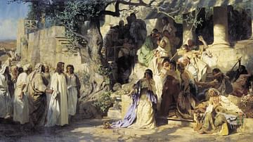
Image
Christ and Sinner
Christ and Sinner, painting by Henryk Siemiradzki, 1873.
Russian Museum, Saint Petersburg.

Image
Drävle Runestone
Drävle Runestone, showing Andvari's ring, the Andvaranaut.
Sweden, Enköping Municipality, Altuna parish.

Image
Ring with Runic Inscription
Gold finger-ring, engraved with a runic inscription, three letters continuing on inside of the hoop, found near Carlisle, England, dated to the 8th-10th century.
The British Museum, London
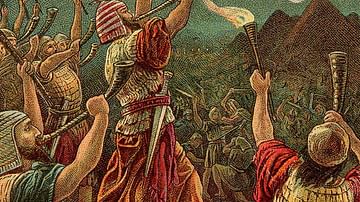
Image
Gideon and his Men
Gideon and His Three Hundred, illustration from a Bible card published by the Providence Lithograph Company, 1907.

Image
The Sacrifice of Gideon
The Sacrifice of Gideon, oil on canvas painting by Hendrik Heerschop, 1653.
Museum of John Paul II Collection, Warsaw.
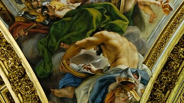
Image
Moses, Gideon, Elijah, and Samuel
Moses, Gideon, Elijah, and Samuel by il Baciccio.
Pendentive of the dome of the Gesù, Rome.
Image
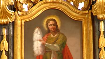
Gideon
The prophet Gideon with the roll of fleece in his hands as depicted on a Greek Catholic icon in the 18th century.
Greek Catholic Cathedral of Hajdúdorog, Hungary.
