
Search Images
Browse Content (p. 740)

Image
Parliament Square, Trinity College Dublin
Trinity College is the only ancient university located in Ireland and was established in 1592 by Queen Elizabeth I of England (r. 1558-1603) as the sole college of the University of Dublin. Most of the buildings...
Image
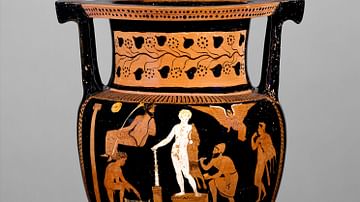
Greek Vase Painting of an Artist at Work
Red-figure vase depicting an artist painting a statue of Hercules, identified by his club and lion-skin cape. Greek and Roman statues were frequently painted in Antiquity, to impart a more impressive and life-like...
Image
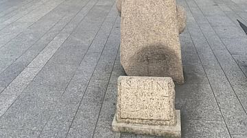
The Steine, Dublin
The Steine is a replica of a Viking longstone standing in Dublin. The use of the original standing stone is not clear, but it is believed to have been raised by the Viking settlers sometime during the 10th or 11th centuries...

Image
Port of Portuguese Macao
A 19th-century painting by an unknown artist of Portuguese Macao, a colony of the Portuguese Empire from c. 1557 to 1999.

Image
Portuguese Macao Map
A map showing the location of Portuguese Macao, a colony of the Portuguese Empire from c. 1557 to 1999. Macao is now a part of the People's Republic of China.
Image
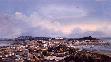
Portuguese Macao Panorama
A panoramic painting of Portuguese Macao, a colony of the Portuguese Empire from c. 1557 to 1999. Painted c. 1870 by an unknown artist.

Image
Medieval Battle Scene
Artist's impression of a medieval battle scene, depicting knights both on foot and horseback fighting.
Image
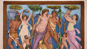
Relief of Dionysus with Restored Colour
Comparison between a relief of a drunken Dionysus with a digitally restored version. Dionysus leans on a satyr while Maenads dance around him. A small Pan tugs on his robe. This restoration shows the relief...
Image
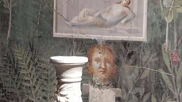
Fresco from the House of Golden Bracelet, Pompeii
Fresco depicting a relief and bust within a garden. From the House of the Golden Bracelet, Pompeii. 1st Century CE.
©Jackie and Bob Dunn www.pompeiiinpictures.com
Image
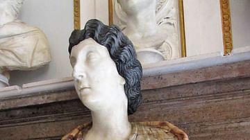
Bust of a Roman Woman, Possibly Lucilla
Roman sculpture of a noble woman, possibly Lucilla, wife of emperor Lucius Verus (r. 161-169 CE). The masterful use of veined marble imitates the pattern of her cloak, while two different marbles give the appearance...
