
Search Images
Browse Content (p. 784)
Image
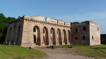
Hindola Mahal, Mandu
The Hindola Mahal, built c. 15th Century CE. Mandu, Madhya Pradesh.
Image
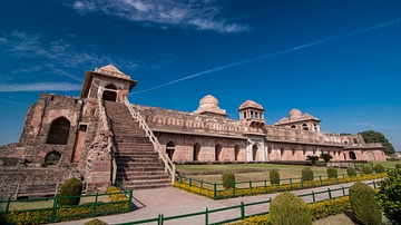
Jahaz Mahal, Mandu
The Jahaz Mahal (built in the late 15th Century CE) in Mandu, Madhya Pradesh.
Image
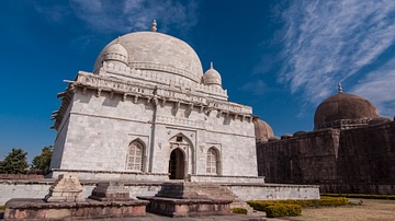
Tomb of Hoshang Shah, Mandu
The tomb of Hoshang Shah in Mandu, Madhya Pradesh.

Image
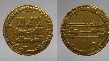
Gold Dinar of Al-Mansur
Dinar (gold coins) minted in the reign of al-Mansur (r. 754-775 CE) of the Abbasid dynasty (750-1258 CE).
Image
Gold Dinar of Al-Mahdi
Dinar (gold coin) minted in 783 CE, during the reign of al-Mahdi (r. 755-785 CE) of the Abbasid dynasty (750-1258 CE).
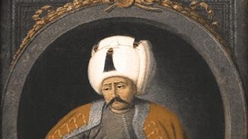
Image
Selim I
This is a painting of Yavuz Sultan Selim I (r. 1512-1520 CE), the ninth Sultan of the Ottoman Empire (1299-1924 CE). Painted sometime between 1789 and 1806 CE.

Image
Calligraphy of Abbas ibn Abd al-Muttalib
A calligraphic vector diagram of the name of Abbas ibn Abd al-Muttalib (c. 568–c. 653 CE), an uncle of the Islamic Prophet Muhammad and progenitor of the Abbasid Dynasty.
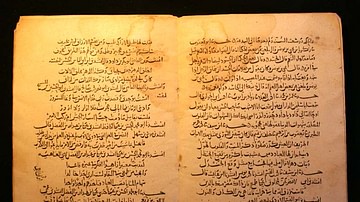
Image
Earliest Abbasid Era Manuscript
This 13th Century CE Arabic manuscript is the earliest manuscript from the Abbasid era (750-1258 CE). The Abbasids initiated a cascade of translation activities to preserve and further aggrandize western and eastern knowledge. Part of the...
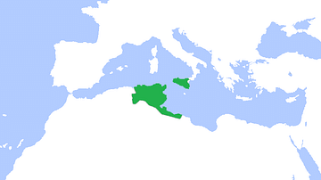
Image
Map of Aghlabid Emirate
This is a map showing the greatest extent of the Aghlabids (800-909 CE).
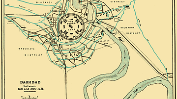
Image
City Plan of Medieval Baghdad
This map shows the layout of the Abbasid capital of Baghdad from 767 to 912 CE (it was subjected to changes with time), situated in modern day Iraq. The basic structure was circular.