
Search Images
Browse Content (p. 895)
Image
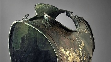
Stična Breastplate
The Stična Breastplate is a 6th Century BCE bronze cuirass from Stična, Slovenia. The cuirass is decorated with anatomical details, not unlike a Greek "muscle cuirass". The breastplate comes from a Hallstatt warrior's grave. This piece...
Image
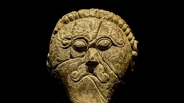
Mšecké Žehrovice Hero
The "Mšecké Žehrovice Hero" (also known as the "Mšecké Žehrovice Head") is a late 2nd Century BCE or early 1st Century BCE limestone bust of a Celtic warrior. The male figure wears a Celtic torc necklace, and has stylized facial features...
Image
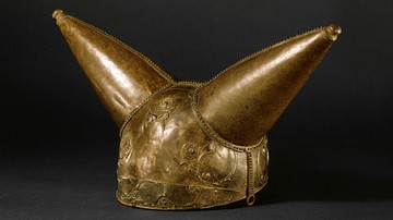
Waterloo Helmet
The "Waterloo Helmet" is an example of a ceremonial horned helmet from Celtic La Tene culture. The helmet was originally decorated with pieces of red glass, and would have been even more visually striking when it was made. It is impractical...
Image
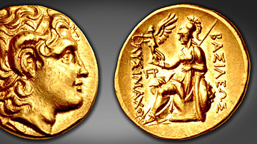
Coin of Lysimachus
Gold stater minted under the authority of King Lysimachus of Thrace (r. 305-281 BCE), show the deified portrait of Alexander the Great, wearing the royal fillet (diadema) with the ram's horn of Ammon on the obverse; the reverse features the...
Image
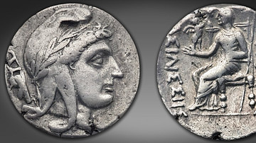
Coin of Amastris
Silver stater issued by Amastris (r. c. 300 - 285 BCE) in Paphlagonia. Neither the youthful portrait nor the enthroned goddess may be a direct portrait of Amastris, but in both Greek and Persian terms they express her claim to rule as queen...
Image
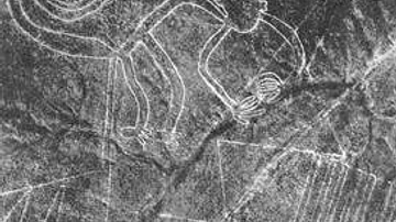
Nazca Line Monkey
Aerial photograph taken in 1953 CE by Maria Reiche (1903 - 1998 CE). Maria Reiche was a German-born Peruvian mathematician and archaeologist who is known for her research on the Nazca Lines in Peru. The photo shows a geoglyph of a monkey...

Image
Maria Reiche in 1910
Maria Reiche (1903 - 1998 CE) was a German-born Peruvian mathematician and archaeologist known for her research into the Nazca Lines in Peru. This photograph was taken in 1910 CE.
Image
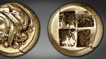
Coin Portrait of Pharnabazus, Satrap of Ionia
This electrum coin (sixth-stater) portrays Pharnabazus (c. 478-387 BCE), the Persian governor (satrap) of Ionia, wearing a diademed Persian cap; behind his head a seal swims downward. (Nomos no. 1 (6 May 2009) lot 107) Photo courtesy...
Image
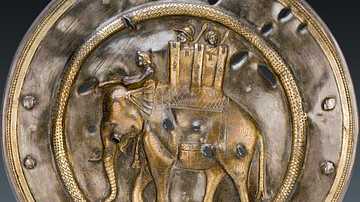
Turreted War Elephant, Hermitage Museum
One of a pair of decorative silver phalerae (horse’s harness plagues) discovered in a grave during Russian excavations, depicting a turreted war elephant wearing a saddle cloth decorated with a hippocampus (Eastern Iran, ca. 3rd-2nd cent...

Image
Itsukushima Shrine
A view of the torri and stilted buildings at the Itsukushima Shrine, Hatsukaichi, Hiroshima Prefecture, Japan. Traditionally founded in the 6th century Ce but extensively remodelled in the 12th century CE.