
Search Images
Browse Content (p. 952)

Image
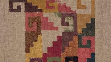
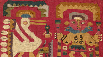
Paracas Mantel
Mantel (Detail), 100 BCE / 200 CE. Paracas; south coast, Peru. The Art Institute of Chicago, Emily Crane Chadbourne Fund.
Image
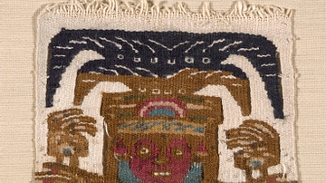
Nazca Textile Panel Fragment
Panel Fragment, 200/500 CE. Nazca; south coast, Peru. The Art Institute of Chicago, Restricted gift of Mrs. Edwin A. Seipp.
Image
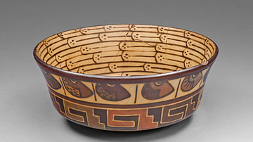
Nazca Bowl with Bean and Architectural Motifs
Bowl with Bean and Architectural Motifs, 180 BCE / 500 CE. Nazca; south coast, Peru. The Art Institute of Chicago, Kate S. Buckingham Endowment.
Image
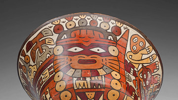
Nazca Culture Bowl
Bowl, 180 BCE / 500 CE. Nazca; south coast, Peru. The Art Institute of Chicago, Kate S. Buckingham Endowment.
Image
Lambayeque Textile Patch
Patch, 1000/1476 CE. Lambayeque; North Coast, Peru. The Art Institute of Chicago, Kate S. Buckingham Endowment.
Image
Lambayeque Textile Panel
Panel, 1000/1476 CE. Lambayeque; north coast, Peru. The Art Institute of Chicago, Kate S. Buckingham Endowment.
Image
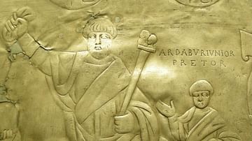
Aspar, Magister Militum
The Missorium of Ardabur Aspar depicts Aspar, magister militum, and his elder son. 434 CE
Image
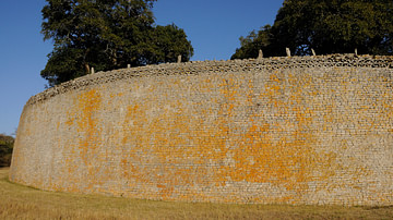
Great Enclosure Wall, Great Zimbabwe
A section of the Great Enclosure of Great Zimbabwe, Zimbabwe. Built in the 13-14th century CE using granite, the wall is 5.5 metres (18 ft.) thick in places and 9.7 metres (32 ft.) high.
Image
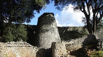
Great Enclosure Tower, Great Zimbabwe
The conical tower of the Great Enclosure of Great Zimbabwe, Zimbabwe. Built in the 13-14th century CE using granite, the purpose of the structure is not known.
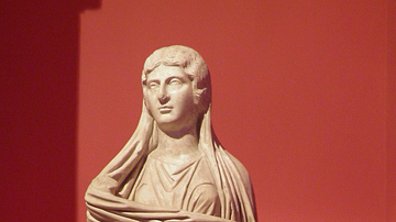
Image
Julia Soaemias
Statue of Julia Soaemias Bassiana (180 – March 11, 222 CE), a Syrian noblewoman and the mother of Roman emperor Elagabalus who ruled over the Roman Empire during her son's reign (218 to 222 CE). The statue was found in Perge and is now in...