
Search
Remove Ads
Advertisement
Summary 
Loading AI-generated summary based on World History Encyclopedia articles ...
Search Results

Definition
Levant
Levant is the name applied widely to the eastern Mediterranean coastal lands of Asia Minor and Phoenicia (modern-day Turkey, Syria, and Lebanon). In a wider sense, the term can be used to encompass the entire coastline from Greece to Egypt...

Article
Interview: Medieval Christian Art in the Levant
Medievalists retain misconceptions and myths about Oriental Christians. Indeed, the fact that the Middle East is the birthplace of Christianity is an afterthought for many. During the Middle Ages, Christians from different creeds and confessions...
Image
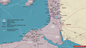
Roman Rule in the Levant, c. 200 CE
This map illustrates the Roman Levant c. 200 CE, encompassing the provinces of Syria Coele, Syria Phoenice, Judea (renamed Syria Palaestina), and Arabia Petraea. It was a culturally diverse and strategically vital region, serving as a trade...
Image
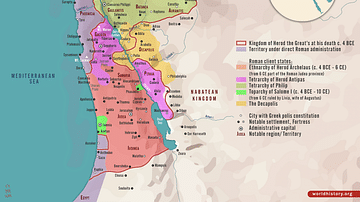
Herodian Tetrarchy in the Levant, c. 5 CE
A map illustrating the geopolitical situation in the Levant after Herod the Great's death (an ambitious ruler appointed as the King of Judea by the Roman Senate in 37 BCE). The Herodian Tetrarchy, established by Herod the Great's will, divided...
Image
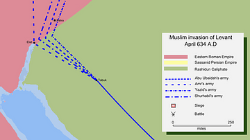
Muslim Invasion of the Levant, 634 CE
A map depicting the Muslim invasion into the Levant, then controlled by the Byzantine Empire, in 634 CE.
Image
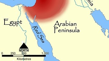
Map of the Levant
This map shows the place of the Levant (highlighted in red) within the eastern Mediterranean.
Image
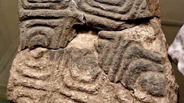
Oldest Large-Scale Slab in the Levant
This is a stone slab incised with a repeated array of concentric irregular squares. A line of 3 slabs bearing this decoration was found in a wall inside "Structure 2" at Wadi al-Hammeh 27. They were supported by a backing of rubble, with...
Image
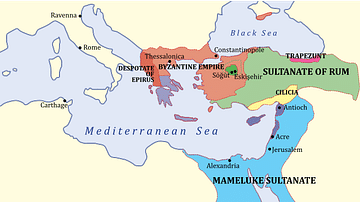
The Levant, 1263 CE
A map showing the various states of the Levant c. 1263 CE.
Light Blue: Mamluk Sultanate
Dark Blue: Latin East
Image
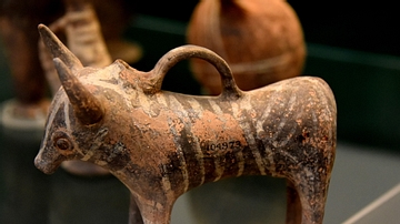
Imported Cypriot Pottery Bull to the Levant
During the Late Bronze Age, the trade contacts established with Cyprus in the preceding period were intensified. This type of bull was very popular in the Levant, either as ornaments or perhaps as feeding bottles. Base ring ware. LBI-II...
Image
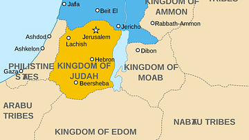
Map of the Levant circa 830 BCE
A map of Palestine circa 830 BC, showing the kingdoms of Israel and Judah, as well as the surrounding kingdoms and tribes.